Big Creek Bridge: The Scenic Big Sur Viewpoint

Introducing Big Creek Bridge
Big Sur has long been referred to as a national treasure for having one of the most beautiful, undeveloped coastlines in all of the United States.
The section of Highway 1 running through Big Sur, in particular, is commonly considered one of the most scenic driving routes in the country, if not the world. Several viewing points and pull-offs on the journey offer visitors spectacular natural sights, left unblemished by the state's restriction of all advertisements and billboards on the highway.
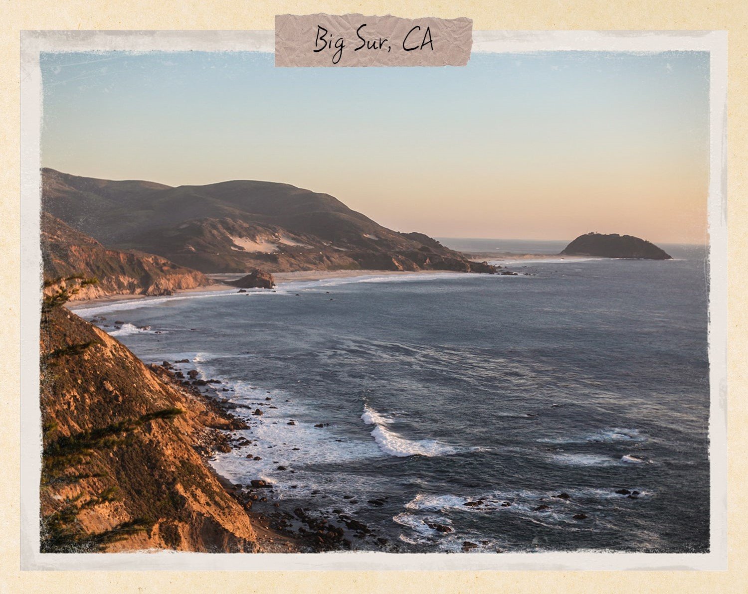
Views from the Big Sur Coast, CA
Standing 65 feet above ground level, Big Creek Bridge is a 589-foot-long open-spandrel, double-arched, concrete bridge located in the Southern region of Big Sur, California. It's also one of the four major bridges on the Pacific Coast Highway (PCH).
Its more famous sister, the Bixby Bridge, typically gets most of the attention as it’s situated at a higher altitude. But here’s the thing. The Big Creek Bridge boasts equally stunning views and a highly similar architectural design, so you might be in for a more peaceful experience by heading there instead.
History of Big Creek Bridge

Big Creek Bridge, Big Sur , CA
The bridge was constructed during the Great Depression as part of the National Industrial Recovery Act of 1933. President Franklin Roosevelt had come into office during the worst depression the country had ever seen, and measures to stimulate economic recovery were critical. The Nation Industrial Recovery Act (NIRA) of 1933 was thus enacted to fulfill the president's campaign promise to provide jobs for the people and promote business activity.
The Public Works Administration (PWA) was tasked with constructing permanent and socially beneficial public works throughout the country. Numerous buildings funded by the PWA have since been recognized for their historical significance and architectural excellence. Among them is the Big Creek Bridge in Big Sur.
Big Creek Bridge was designed by Christian Theophil Gutleben, a civil engineer based out of San Francisco, California. He is well-known for his reinforced concrete arch bridges all throughout the California coast and the Los Angeles region.
Much like the Pacheco Pass, Big Creek Bridge has served many travelers over the years and has undergone several restoration efforts. For instance, the structure got a seismic retrofit in 1999.
Driving to Big Creek Bridge
Driving Directions

The Drive to Big Creek Bridge
As you drive north along Highway 1 on the Big Sur Coast, you'll eventually spot the striking Big Creek Bridge. It nestles nicely against the backdrop of the rocky hills and coastline, and the double gray arches simultaneously stand out and integrate into the surrounding rocks on either side.
Location of Big Creek Bridge
Big Creek Cove Beach
Big Creek Cove Beach is also located right below the bridge. However, public access to the Landels-Hill Big Creek Reserve and the beach is unfortunately restricted and off-limits to the general public.
With fewer crowds and equally breathtaking sights as its more famous counterpart, Big Creek Cove Beach has become a favorite for some looking to capture the ultimate depth-of-field selfie or to revel in 360-degree vistas on the lonely coast road.
Where to Get the Best Views of Big Creek Bridge
There are several pull-out parking spaces at both ends of the Big Creek Bridge for drivers to stop and capture photographs. You'll get the best view from the bridge's south end, at about 0.5 miles away. There, you'll get a distant but unobstructed view of the bridge and the beach below. A trace of the gorgeous PCH will also be clearly visible from this viewpoint.
Other Attractions and Activities in Big Sur
Apart from Big Creek Bridge and Bixby Bridge, there are multiple state parks and publically accessible spots along this 90-mile mountainous Big Sur region worth stopping by.
One to consider is Pfeiffer Beach, located just over a mile south of the Pfeiffer Big Sur State Park. Though this slightly off-the-beaten-path beach is accessible only by cars and not RVs, the winding drive and short trail from the parking lot will be worth the breathtaking views.
From there, you'll get sweeping ocean vistas that are unmatched anywhere else on the coasts. Backdropped by the magnificent Santa Lucia mountains, the beach's main attraction is Keyhole rock, an enormous, naturally arced rock formation.
Limekiln State Park is another gem that embodies much of what makes Big Sur so special. It offers over 700 acres of land, including redwood forests, hiking trails, picnic areas, and campsites. If you're looking to witness all that Big Sur has to offer in more than just a day's drive, we'd recommend camping out and spending some time at Limekiln Falls.
We've compiled some activities for you to check out if you're looking to discover more of Big Sur with some guidance.